For the third year in a row, Charlie and I roadtripped down to Utah over Memorial Day weekend.
In 2012, we hung out in Moab and checked out Arches and Canyonlands National Parks.
In 2013, we visited Bryce Canyon National Park.
This year, our destination was Zion National Park.
I hope you're comfortable (go grab something to drink) because we have a LOT of pictures to share and I can't help but include a few stories along the way.
As far as National Parks go, it's not a huge one. The park itself is 229 square miles of canyons and high plateaus located at the overlap of the Colorado Plateau, Mojave Desert, and Great Basin. The closest "city" to the park is St. George, Utah, though there are some really cute towns just outside catering to tourists.
So. Let's get to it. Pictures and other fun stuff.
WEDNESDAY:
DRIVING, DRIVING, DRIVING.
We left Boise late Wednesday afternoon. Our plan - same as the last three years - was to drive approximately 5 hours to the greater Salt Lake City area, and stay the night in a hotel that was close to the highway so we could make an early getaway the next morning.
Boise was rainy and windy as we loaded up the Subaru and hoisted our bikes onto the roof. It was our first time using our new bike racks (thanks, Dan and Sue!) and I definitely had my fingers crossed that I'd installed them correctly and that our bikes wouldn't end up somewhere on the side of I-84 somewhere under a sagebrush.
Because I tend to drive the first leg of these trips, leaving Charlie to do the final, sleepy stretch into town, I took advantage of the situation and booked us a hotel in Provo, Utah (home of BYU),
45 minutes south of Salt Lake.
As you can tell, our room was very fancy (dream big, Baymont Inn, dream big).
Our first night's "campsite." Not to mention one last chance at a hot shower for the weekend.
THURSDAY:
ARRIVAL AND ORIENTATION.
One thing I've learned about being married to a university professional is that if you're staying near a campus, you can expect that your partner will want to stop in and visit.
Sure enough, our hotel was just a stone's throw from BYU, so after a short driving tour of campus ("Look, Ariel! It's the student union! And, look! The Physical Plant!") we picked up some final necessities at Shopko (similar to a Kmart), and hit the road south.
A few hours (and only one missed intersection later) we found ourselves in Zion.
Our first stop was at the visitor center, where we ditched the car and stretched our legs on a short walk down to the Virgin River.
Since it was already afternoon, our primary order of business for Thursday was to get oriented and get a feel for the park.
Only 130 miles from Vegas, Zion is Utah's most visited park. As such, they've had to figure out how to handle the volume of cars and RVs that flood into the narrow canyon every year. During the peak summer months, the park has instituted a shuttle system: no cars are allowed on the main canyon road unless you have a medical condition that allows you to get a special permit.
We were a little apprehensive about this. At past parks, we've driven to the trailheads we wanted and used our car as a sort of base camp while we were out and about in the park. Fighting parking had never been a serious issue in the past.
With that in mind, I've really got to hand it to Zion: this is the best thing that could have happened to it - and I'd go so far as to advocate that they expand that system to other parks, too.
The buses run on propane (!!!) and are quiet and clean. They ran frequently, we never had to wait more than 5 minutes to catch one, and even though it was a record-setting weekend for the park while we were there (80,000 people over the weekend - wow), we never had trouble getting on one. Plus, it opened up the park roads for bikes, letting us enjoy the amazing views in relative peace.
After riding the shuttle to the end of the road, we made our first stop for a short hike up to the Hanging Gardens. This place highlighted one of the coolest things about the geology of the canyon (in my opinion): the Navajo Sandstone is porous and so it absorbs rainfall. The water seeps down through the rock, and when it hits a denser type of rock (I think it was shale in this case? Maybe slate?) the water is pushed out of the rock walls and provides a moist place for plants to grow.
By the time we finished this hike, it was time to head back to the car and set off to our campsite at nearby Quail Creek State Park (a little more on this later).
FRIDAY:
BIKES AND HIDDEN CANYONS.
The next day we got up at the crack of dawn, rolled out of our tent, and set off for the park. We wanted to get there as early as we could stomach so we could get a parking spot inside the park and not have to shuttle in from an overflow lot a couple miles away. I'm more of a morning person than Charlie is, but he was a good sport - even when I photobombed his selfie.
Friday started off with a bike ride. The road through the park is about 6.5 miles long (short) but we were glad that we brought our bikes anyhow. Riding through the park really gives you a sense of scale that's hard to get when you're in a vehicle. I can't emphasize enough how nice it was to only worry about the shuttles - which, by the way, aren't allowed to pass cyclists. When a shuttle shows up behind you, you're required, as a cyclist, to pull to the edge of the road and put a foot down. Only then can the shuttle go around.
There aren't any pictures of me with my bike, mostly because I have a pair of those darn spandex bike shorts and you all don't need to see me rocking my "squeezed" look.
After our bike ride, we set off on a short hike up to the Emerald Pools, a series of small ponds on terraces along the canyon wall that have a green color (due to algae growth). It was purdy, but we really started to feel the fact that it was Memorial Day weekend: this trail is easy and popular - and consequently it was packed with people. And it was only Friday.
After eating a quick lunch at the upper pool, we set off back down the trail. We were a little fried with the "tour group" feel of this sort of uber-popular hike, so decided to do one with a little more amplitude: Hidden Canyon.
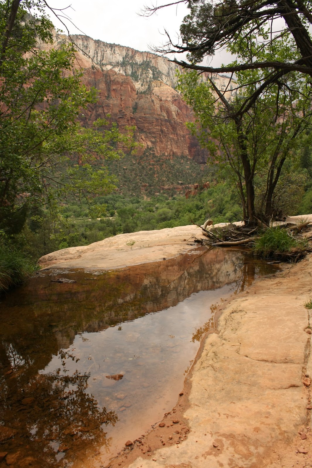
View down the canyon from the Kayenta Trail on the hike out from the ponds.
Not quite as sneaky as it sounds, Hidden Canyon hauls butt up the steep canyon wall, switchbacking back and forth. It's only about 2.4 miles round-trip, but zooms up almost 1,000 feet in about the first .75 miles. It was a good taste-test for the infamous Angels Landing hike, which, at this point, we hadn't decided whether we were going to do or not.
Check out the chains bolted onto the rock walls in the photo above. The reason those are there? Just to the right of me in the picture it's about 800 feet straight down to the valley floor. Wheeeee....
The hike ended in a narrow canyon with some great pools set in the rocks. Well, that's where it ended for us anyhow. You could keep scrambling back into the canyon, and apparently there's a great natural rock arch, but it was starting to rain a little, and I was taking all the flash flood warnings seriously. So, I suggested we turn back. Yay for Ariel the adventure-killer!
See our raincoats and my crazy hair? Definitely raining. Promise. (Ahem, in the Utah sense of the word.)
After biking about 15 miles (for those keeping track that 6 x 2 does NOT equal 15, we had to turn around and re-trace our route when we realized we'd forgotten something, adding a couple extra miles to the overall ride), and hiking about 7 miles, we were ready to call it a day.
We'd reserved a campsite at Quail Creek State Park, a great campground on a reservoir about 35-40 minutes from the park entrance.
The park had great views of the reservoir and the painted cliffs behind it. It was especially awesome at sunset.
SATURDAY:
ANGELS LANDING, RIVERWALK, TUNNELS, GHOST TOWNS, AND BEER.
The sunrises at Quail Creek weren't too shabby either.
On Saturday morning we also saw a little local color en route to the park.
Nothing says "family" to me like a drive-through pawn shop. But, we're all raised differently, I suppose.
Stay klassy Hurricane, UT.
So, between the sunrise and the good laugh we had over Family Pawn, we decided that Saturday seemed auspicious for doing the infamous Angels Landing hike.
Angels Landing is a gorgeous hike and fairly reasonable in terms of distance and elevation gain. It was listed in the park's "strenuous" hikes section. The area guidebook we had (as well as all the park literature) really talked it up.
Here's what Wikipedia has to say about it (the hike has its own page - and yes, editing-minded friends and teachers among us, it really is "Angels" Landing with no apostrophe):
According to the National Park Service, "The route to Angels Landing involves travel along a steep, narrow ridge with support chains anchored intermittently along the route. Footing can be slippery even when the rock is dry. Unevenly surfaced steps are cut into the rock with major cliff dropoffs adjacent. Keep off when it is wet, icy or thunderstorms are in the area. Plan to be off before dark. Younger children should skip this trail; older children must be closely supervised." The National Park Service website officially recognizes five fatalities where suspicious activity was not involved along Angels Landing, however other deaths have been reported.I'm not a huge risk-taker when it comes to things like this, but knowing that we're pretty decent hikers (and thousands of people survive the hike annually), we decided to go for it.
The hike is roughly 5 1/2 miles round trip and gains a little less than 1,500 feet in elevation along the way. Up, up, up.
If you have three minutes, you should really check out this guy's video. He took a GoPro camera with him on a stick, and really captures what it felt like to be on this crazy hike: https://www.youtube.com/watch?v=ILFpA4wv9EQ
We didn't stop for photos on the way up. Even with our early start (we were on the trail before 9 am), it was still a pretty incredible human traffic jam on the way up and even worse on the way down. Lots of waiting and letting long lines of people traverse the precarious trail before taking our turn.
We made it! We didn't die!
The views up-canyon (above) and down-canyon (below) were spectacular. Best seat in the house.
Of course, the worst part about hiking UP to Angels Landing was then having to hike DOWN from Angels Landing.
We did find the opportunity on the way down, though, to snap a few pictures of what the trail ahead and behind us looked like.
In the picture below, you can see folks taking a breather on the way up, while also checking out the narrow spine of rock that the trail makes its way along. Ooph.
In this one, you can see the chain that you had to option of clinging to for dear life as you hoped to God that you didn't catch your toe or stumble on the way down.
I think the picture above actually captures the place along the trail where you had to literally climb over or under the chain in order to stay on the trail.
People, seriously.
The next one looks back up toward the top from about halfway down. This is from the place where, on our way up, we thought we were "there" and had reached the end of the hike. That until we noticed the ant-humans crawling their way up the edge. Phew.
Once you get off the ridge, the rest of the trail is no big deal. This section below is called "Walter's Wiggles." It consists of over 20 switchbacks working their way up the side of the cliff. You can't tell from the angle here, but it's actually quite steep.
At the bottom of Walter's Wiggles (or just before it if you're coming up - we're doing this hike in reverse, sorry!) is "Refrigerator Canyon," a narrow break in the rock that is about 10 degrees cooler that everywhere around it. It's also full of birds, trees, and solid rock on either side of you.
In the end, it was totally worth it. This picture below is about 1/2 way up (or down, which way are we going again?). You can see the trail way below on the right.
The trail ends by crossing the Virgin River at the bottom on the canyon.
After Angel's Landing, we were looking for something a little more tame, so we hopped the shuttle up-canyon to take a stroll on the River Walk trail. Had we been a little more prepared (with closed-toed river shoes) we'd have hoofed it upstream along the famous Narrows trail (the "trail" is actually the riverbed, and it goes for a couple miles upstream into the deep canyon - oh well, next time!), but even that was packed with people.
Instead, we enjoyed lunch by the river before heading back down to the visitor center.
We wrapped up Saturday in the park by pulling the bikes off the roof, stuffing them into the back of the Subaru, and embarking on the Mt. Carmel highway. This is a gorgeous drive that leaves Zion Canyon and heads east, up into the slickrock area surrounding the park.
The most famous part of the drive is the crazy tunnel. Over a mile long, and only 11 ft tall and 7 ft wide. There are restrictions of who can and cannot travel through it. Large RVs and other vehicles have to pay for a ranger escort through the tunnel. The only light in it comes from these giant gallery "windows" that they blasted through the rock when they built it. Here you can see two of them. I think there were 4-5 total.
This is another tunnel along the road. A little less impressive (I mean, come one, you can see the light at the end of this one... weak!), but it gives you a sense of how they blasted these through the rock wall.
Pictures of the terrain on the other side of the tunnel. A little different than the rest of the canyon.
This is called Checkerboard Mesa, due to the unusual "scoring" across its face that looks like a checkerboard.
After our drive, on our way back to the campground, we rewarded ourselves with some chicken wings and a tasty cold beer at a brewery just outside the park. After Angels Landing, we felt like we deserved it.
After our snack, we took a short detour to nearby "Grafton" a well-preserved ghost town outside of Springville. You may recognize some of the buildings in Grafton - it's considered one of the most photographed ghost towns of the west. The famous bicycle scene of the movie Butch Cassidy and the Sundance Kid was filmed here. The last resident left Grafton in 1944. If you want to read more about it, here's a link: http://en.wikipedia.org/wiki/Grafton,_Utah
Nice view, cows.
The mounded graves were a little strange. Most of the graves in the Grafton cemetery were that way.
Each of these three graves had "Ind" before the name. Charlie and I guessed that stood for "Indian" - but don't know that for sure. Ideas?
Here's the schoolhouse.
We're not totally sure, but we think this is the Butch Cassidy house from the movie.
Here are a few more nice pictures of our last night at Quail Creek.
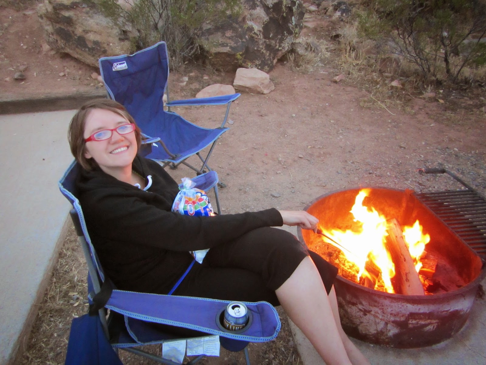
I love my marshmallows.
On Sunday, we decided to skip the craziness of the main park road, and headed north up to the less-visited "Kolob Canyons" region.
From the viewpoint a mile past the end of the road, you could see all the way to the Kaibab Plateau - on the northern rim of the Grand Canyon.
The red rock walls of the Kolob Canyons were amazing as the sun rose.
By the time we got back to the parking lot, the number of cars had gone from three to about 15, so we skeedaddled back down the road to our next stop: a backcountry hike along Taylor Creek to Double Arch Alcove. This was an amazing, five mile hike back into a box canyon.
Oh yeah, we also saw a wild turkey.
Along the hike, there were a couple pioneer cabins circa 1930. Not a bad view from this one.
At
the end of the hike, we found ourselves in this amazing alcove. As at
Hanging Gardens, the walls here seeped water and the area at the base
of the alcove was full of columbine and other plants.
The
acoustics in this place were outstanding: birdsong and the dripping
water - it was so peaceful and quiet. Well, until the next group of
hikers showed up. Our timing this day was really on target - on our hike
out we passed group after group of hikers along the trail. But while we
were there, we had the place to ourselves. Gorgeous.
Once we hiked out of the canyon, we set off for our next campsite: Snow Canyon State Park.
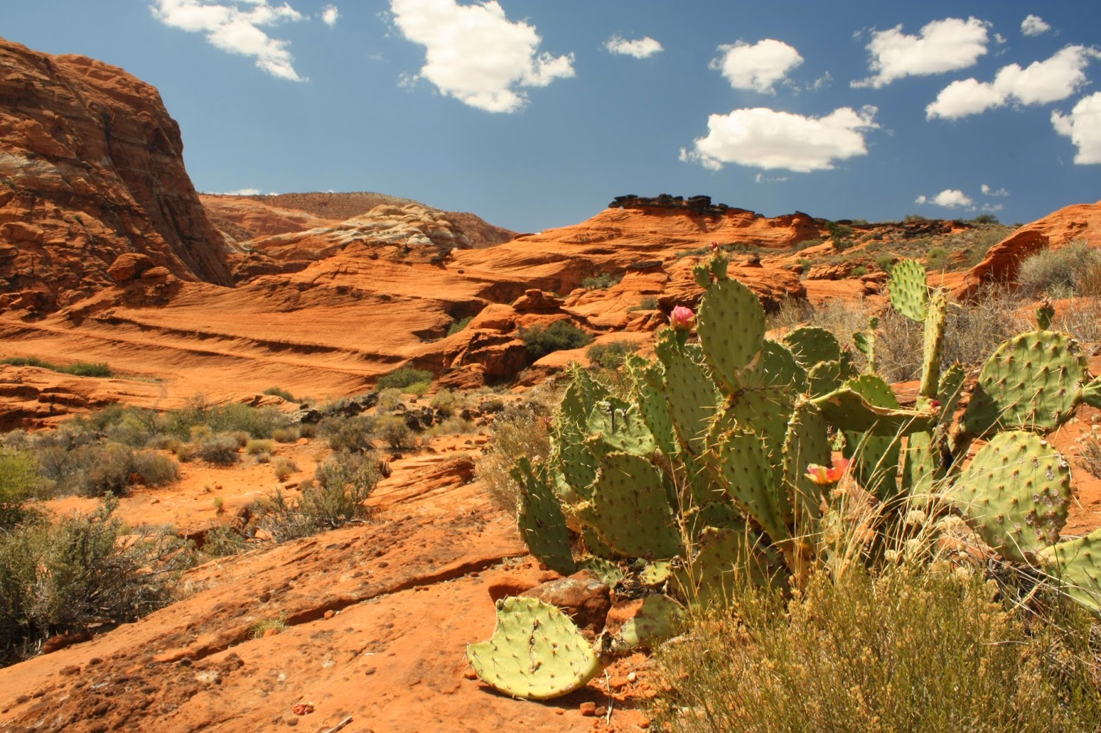
Minutes outside of St. George, Utah, Snow Canyon is an amazing, red-rock extravaganza. Petrified dunes, tall red rock walls, and deep red sand. It truly felt like the desert. The fact that the temperatures were rapidly rising above 90 degrees certainly helped that impression.
Once we got checked in and parked, we, naive northwesterners that we are, decided to go for a hike.
It was miserable hot.
We could have spent our whole vacation exploring just this state park.
One of our favorite features was the custom "warning" signs at either end of the park road (signed by the artist!).
There was also one for desert tortoise crossing. We really hoped to encounter one of these, but never did. Here's what we were supposed to do if we found one (keep in mind they are an endangered species). From the park brochure:
"What should I do if I see a tortoise crossing the road?"
If the tortoise is in harm's way, stop your car in a safe place along the roadside.
Slowly approach the tortoise, noting the direction of travel.
Carry it carefully across the road in the same direction, taking no more than 100 feet from the roadway. Be sure to hold the tortoise upright, in its normal walking position, using both hands. Don't tip it from side to side or turn it upside down.
Once the day cooled off a little, we set up camp. Nice spot, huh?
We left the rainfly off during the night, and it was incredible to sleep "under" a huge night sky full of stars. Wonderful.
Before dinner, we did one last little hike: this one to the top of a petrified dune.
According to the recording on the Zion shuttle, millions of years ago, this area was one of the world's largest sand dune deserts (think the Sahara Desert). As the sand built up and rain and minerals filtered down through the dunes, it hardened into rock. That rock was then eroded into the unusual, wind-swept shapes of the petrified dunes.
"No, Charlie, you need to pose with your whole body."
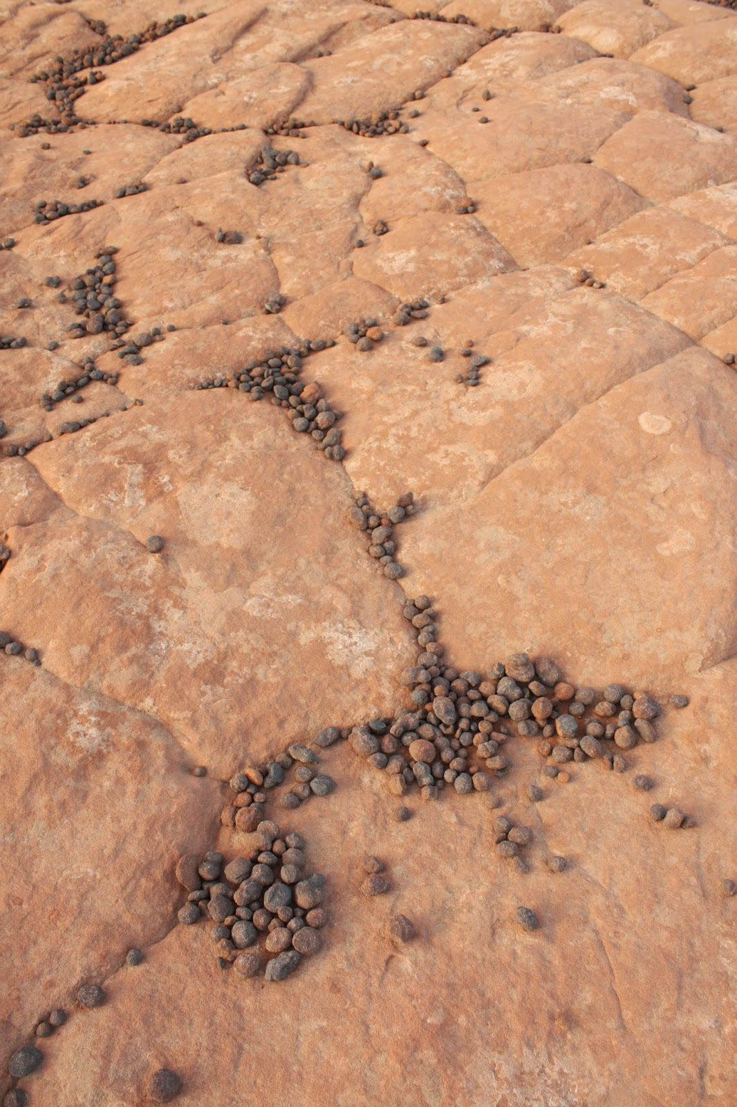
One of the most interesting features of the petrified dune was the Moki Marbles. These are formed when a deposit in the stone is more iron-heavy than the rock around it, so the surrounding rock erodes. What's left are these little round "marbles." Thousands of them.
Our last short hike of the trip was a walk to a place called "Pioneer Names" where early settlers of the area wrote their names on the rock with axle grease.
And that's about all she wrote.
(Except for...... Joshua Trees!!)
Our last night in the area, we stayed up late, tipped our heads back enjoyed the stars, and had the kinds of introspective conversations that campfires and constellations prompt. Then we fell asleep to the sounds of the desert.
Like all the Utah parks we've been to, these were jaw-dropping and awe-inspiring.
There's so much to see... it just means we have to go back, right?


OMG Ariel! I didn't realize you ever wrote here anymore! But gosh does this sound like an awesome trip! (Fricken LOVE Utah). So gorgeous!
ReplyDelete(-stasia:)